
Grades 3–5
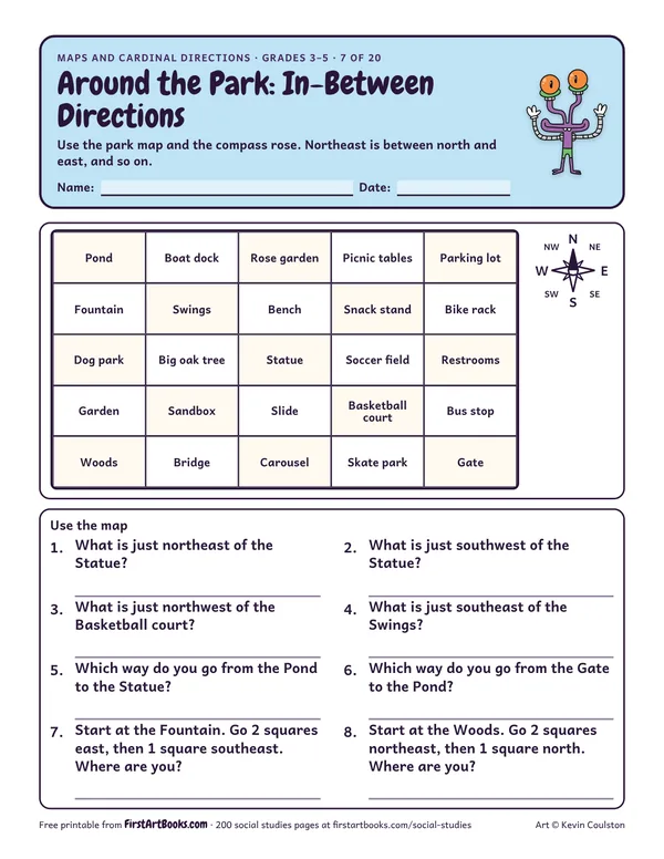
Around the Park: In-Between Directions
A 25-square park map for the intermediate directions: what is northeast of the statue, which way is the gate from the pond, and more.
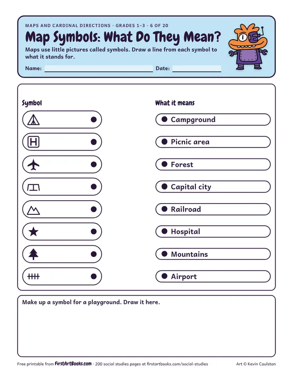
Match 8 common map symbols (tent, H, airplane, picnic table, mountains, star, tree and railroad) to what they mean on a map key.
“Maps use little pictures called symbols. Draw a line from each symbol to what it stands for.”
Printed on the sheet:
SymbolPicnic areaForestCapital cityAirport
Show a real park or zoo map with symbols.
Kids who think north means “up” on any page. Turn the map and talk about it.
Make a class map of the playground with a key.
US Letter, prints well in black and white. Free for home and classroom use: print as many copies as you need.
A 25-square park map for the intermediate directions: what is northeast of the statue, which way is the gate from the pond, and more.
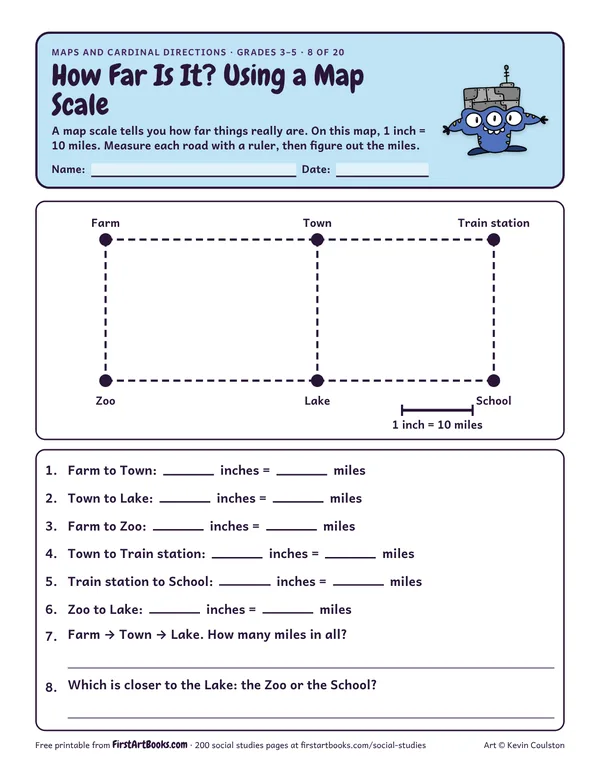
Measure straight roads with a ruler on a map drawn to scale (1 inch = 10 miles) and work out the real distances between the farm, the town, the lake and the school.
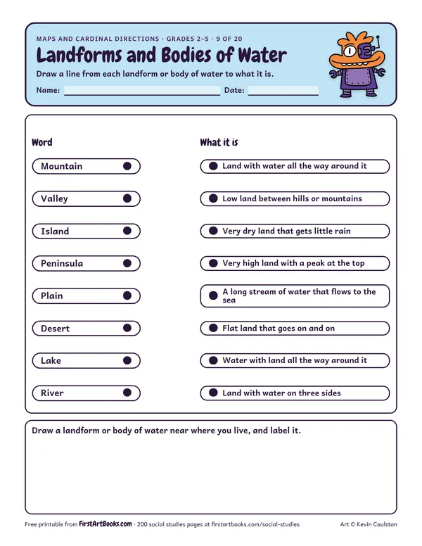
Match 8 geography words, from mountain and valley to island, peninsula, lake and river, to their meanings, then draw a landform you have seen.
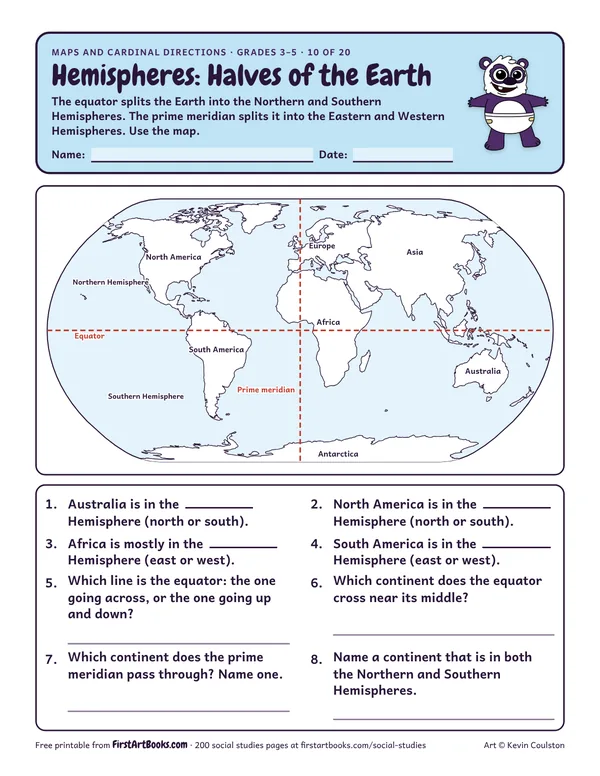
A world map with the equator and prime meridian drawn in: name the hemisphere each continent is in and answer questions about the two halves of the Earth.
12 printable pages: six step-by-step lessons, a grid activity, draw-and-write sheets and teacher notes, sent with your welcome email. After that, new classroom printables by email.